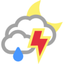
Estado do tempo em Wayne
Avisos
Severe Thunderstorm Watch issued June 5 at 1:06AM CDT until June 5 at 3:00AM CDT by NWS Norman OKSEVERE THUNDERSTORM WATCH 392 REMAINS VALID UNTIL 3 AM CDT EARLYTHIS MORNING FOR THE FOLLOWING AREASIN OKLAHOMA THIS WATCH INCLUDES 8 COUNTIESIN CENTRAL OKLAHOMACLEVELAND MCCLAIN POTTAWATOMIEIN EAST CENTRAL OKLAHOMASEMINOLEIN SOUTHERN OKLAHOMAGARVIN JEFFERSON STEPHENSIN SOUTHWEST OKLAHOMACOTTONTHIS INCLUDES THE CITIES OF BLANCHARD, DUNCAN, LINDSAY, MOORE,NEWCASTLE, NORMAN, PAULS VALLEY, PURCELL, RINGLING, RYAN,SEMINOLE, SHAWNEE, TEMPLE, WALTERS, WAURIKA, WEWOKA,AND WYNNEWOOD.
National Weather Service
Flood Watch issued June 4 at 9:58PM CDT until June 5 at 7:00AM CDT by NWS Norman OK* WHAT...Flooding caused by excessive rainfall continues to bepossible.* WHERE...Portions of central, east central, southeast, and southernOklahoma, including the following counties, in central Oklahoma,Cleveland, Grady, Lincoln, McClain, Oklahoma and Pottawatomie. Ineast central Oklahoma, Pontotoc and Seminole. In southeastOklahoma, Atoka, Bryan, Coal, Hughes, Johnston and Marshall. Insouthern Oklahoma, Garvin and Murray.* WHEN...Until 7 AM CDT Wednesday.* IMPACTS...Excessive runoff may result in flooding of rivers,creeks, streams, and other low-lying and flood-prone locations.Area creeks and streams are running high and could flood with moreheavy rain.* ADDITIONAL DETAILS...- A complex of storms is expected to bring heavy rain to areasalready saturated from previous rains.- http://www.weather.gov/safety/floodYou should monitor later forecasts and be alert for possible FloodWarnings. Those living in areas prone to flooding should be preparedto take action should flooding develop.
National Weather Service
Flood Advisory issued June 4 at 10:34PM CDT until June 5 at 2:30AM CDT by NWS Norman OK* WHAT...Flooding caused by excessive rainfall is expected.* WHERE...Portions of central, east central, southeast, and southernOklahoma, including the following counties, in central Oklahoma,Cleveland, McClain and Pottawatomie. In east central Oklahoma,Pontotoc and Seminole. In southeast Oklahoma, Hughes. In southernOklahoma, Garvin and Murray.* WHEN...Until 230 AM CDT.* IMPACTS...Minor flooding in low-lying and poor drainage areas.* ADDITIONAL DETAILS...- At 1034 PM CDT, Doppler radar indicated heavy rain due tothunderstorms. Minor flooding is ongoing or expected to beginshortly in the advisory area.- Additional rainfall amounts of 1 to 2 inches are expectedover the area. This additional rain will result in minorflooding.- Some locations that will experience flooding include...Ada, Pauls Valley, Purcell, Holdenville, Sulphur, Davis,Wewoka, Wynnewood, Lexington, Stratford, Konawa, Wetumka,Maysville, Byng, Maud, Allen, Roff, Wayne, Paoli and Bowlegs.- http://www.weather.gov/safety/floodTurn around, don't drown when encountering flooded roads. Most flooddeaths occur in vehicles.Be especially cautious at night when it is harder to recognize thedangers of flooding.
National Weather Service
Estado do tempo em Wayne

67 °F
Nublado, trovoadas com chuva
Dá a impressão de
Pressão atmosférica
Ponto de orvalho
Humidade
Visibilidade
Nascer do sol
Pôr do sol
Duração do dia
Data e hora
66°
29.7 pol.
67°
100%
9.9 mi
06:15
20:40
14 h 25 min
5/06 12:55 am
Observado em
Tempo hoja
Mais quente e mais frio
Bilma, Niger
99°
Sibi, Pakistan
95°
Nāḩiyat al Fuhūd, Iraq
88°
Kom Ombo, Egypt
62°
Al Wafrah, Kuwait
53°
Murupara, New Zealand
42°
Santa Bárbara, Bolivia
37°
Savissivik, Greenland
34°
Torres Del Paine, Chile
32°
McMurdo Station, Antarctica
-19°